Saturday, September 14, 2013

Flaming Gorge, Utah

Sunday Sept 8th –  We left the City of Rocks and were headed towards home. We had looked at the map and realized that we would be going right by Flaming Gorge National Recreation Area, just on the southern border of Wyoming, and half in Utah. We had read an article on this gorge in a travel magazine and thought that it would be fun to see.

On our drive from City of Rocks to Flaming Gorge, we had a bit of rain. It was about the first rain that we had encountered on this trip, and the temperature dropped to a chilly 55 degrees or so. I guess, it just seemed to tell us that Fall was rapidly approaching, at least in this part of the country, and we were on the right track to be heading south.

We got to the campground that we had noted in the magazine – Lucerne Valley- and the first thing we noticed were these antelope!

IMG_3556

They were just hanging out……along the roadside…..

IMG_3515

And in the campground.

IMG_3517

They did not seem tame, just unconcerned about us. We might be used to seeing deer at our cabin….but not antelope!  Well, we are “where the deer and the antelope play……”.

We had arrived at the campground around 3:30 pm, wanting to get in early enough, without reservations, to get a nice spot. The campground registration was closed……we thought because it was Sunday. We later found out that they were not staffed after Labor Day. Their season was coming to a end…..

We lucked out and got this campsite…….right by the Flaming Gorge Reservoir.

IMG_3519

It was a nice site, and even without trees or bushes, it felt private. We had a great view of the water out of our back window.

IMG_3525

There was a nice path from our campsite right down to the water’s edge.

IMG_3523

We unhitched our camper, then drove over to the Marina store to pick up some information about Flaming Gorge. We decided against getting out and sightseeing, as the weather still was sprinkling rain, and the driving distances to the hiking trails and overlooks seemed to be 30+ miles. We settled in with our brochures to plan the next few days activities.

Friday, September 13, 2013

The Decision to Head Towards Home

Sunday, Sept 8th- When we head out on a trip such as we did this one at the end of July, we have some things planned out, and some things we leave open ended. We find that we travel better when we have some ideas about what we might like to see or do and we usually have a proposed time frame for our trip, though that too is often open ended.

Somewhere along the road …..sometime during each trip…… we find ourselves asking if we have done what we had wanted to do. Are we ready to start heading back towards home.

That time came after our rafting trip….and again while we were at the City of Rocks.

IMG_3458

Many things pull us in the direction of home……family, friends, our cabin, and things that we want to do at home. Just as steady is the pull towards adventure and the open ended schedule of the road. A push/pull ambivalence that we try to balance……This time, the pull towards home won out (as it inevitably will).

We have been gone 6 weeks so far, and we want to spend some time at home before our next trip (Yes, we already have the next trip scheduled). Besides, we have to get home to our bees….Oh yeah, that’s a future blog!

We have had great fun and good memories on this trip. We have made new friends and explored more than one back road. There is more that we would like to do and see in this area of the country….we could not possibly do it all. But then, we will just have things to do here the next time we pass through.

Today, we are heading eastward – the direction of home. We are not quite done with the adventure…..as we have a few more places that we would like to explore on our way home. We are not sure of our arrival date, but we ARE homeward bound.  : )

Thursday, September 12, 2013

City of Rocks, Idaho

Thursday Sept 5th – Sat Sept 7th, 2013 – Thursday, we drove south from Salmon to the City of Rocks National Recreation Area, just south and west of Pocatello, Idaho.

IMG_3507

Starting in 1843, California Trail Pioneers traveled through this area, stopping at what looked like “a dismantled, rock-built city of the Stone Age”.


IMG_3470

In this area they found shelter, water and graze for their livestock. In 1852, some 52,000 people passed through City of Rocks on their way to California.


IMG_3464

  Some of the various rock formations were given names. This rock was called Camp Rock.

IMG_3463IMG_3472

On some of these giant rocks, the travelers inscribed their names and the date they were there……..

IMG_3473

Sometimes using axle grease or chipping into the rock. Many of these inscriptions are still legible. (It gives one a new appreciation for axle grease!)

IMG_3496IMG_3495

This is Register Rock……..with more names and dates……

IMG_3498IMG_3500

I imagine that the pioneers wanted to say “I was here”. They had made it through 2/3 of the journey, and many hardships. They may have, also, read the names of those who had been there before them to see if family or friends had made it to that point.

IMG_3505IMG_3506

As we read the names, we wondered about all those people and their stories……

IMG_3476

We took our time exploring all the different areas of City of Rocks……

IMG_3479

We hiked a couple of trails, and walked around the giant rocks……

IMG_3480

Fred even climbed a rock or two.

IMG_3491

I was content to just and soak up the beauty……

IMG_3483

And to think about how many others had traveled through this area and had sat in the shelter of these rocks. I pictured the children running around and climbing on all these rocks as our kids would have done when they were little - or might still do……

We camped at the Smoky Mountain Campground inside of the park.

IMG_3456

It really was a lovely site, and very quiet with no one next to us. We took advantage of this site, staying 3 nights, cooking out and enjoying the camp life. One night, the sky was clear with no moon and the stars were out……millions of stars……more brilliant than you can see close to a city! We even saw the Milky Way painting its faint trace across the sky…….

Wednesday, September 11, 2013

Salmon, Idaho and the Sacagawea Interpretive Center

Wednesday, Sept 4th – Our time in Wallace wrapped up our exploration of Northern Idaho. We were now heading south through the town of Salmon. The drive was pretty and followed some of the area that Lewis and Clark had been through as they determined which route across the Bitterroot Mountains to take.


IMG_3454

We had read about the Sacagawea Interpretive center in Salmon. It is unique as the only interpretive center along the Lewis and Clark trail that is devoted to the Lemhi-Shoshone guide who was the only female member of their party.

We had driven about 6 hours, but crossed from pacific time to Mountain time, losing an hour that we had not counted on. We arrived in Salmon about 3:30 pm, a bit worried about getting to the Interpretive Center with enough time to visit before the  5pm closing. We hastily chose an RV park  in town, dropped the camper and headed out to see Sacagawea.

IMG_3439

We arrived at the Interpretive Center about 4pm. We were disappointed with this whole experience. We really had been expecting more……this area had been home to Sacagawea and her Shoshoni people. The interpretive center was small and limited in information. The volunteer in the center kept telling us that he had wanted to leave early that day. We felt rush looking at what small amount of info that they had. We watched a short film that focused on Lewis and Clark, and barely made mention of the Shoshone natives much less Sacagawea.

After a hurried visit in the center, we strolled around the short interpretive trail……

IMG_3440IMG_3441

The few displays were well done, but limited in explanation.

IMG_3445

The trail meandered down to the river front…….

IMG_3442

And included displays of teepees…… canvas……

IMG_3447

And grass covered. Things were set up to look like a native village, but no mention was made of how Sacagawea fit into the picture. This could have been so much more……

We went back to our camper. In our haste, we had chosen a small RV park where we were back to back with another camper. It is nights like these that I am glad that we are self contained. We could close the blinds and pretend that we were by ourselves.

Monday, September 9, 2013

The Hiawatha Trail–Ten Tunnels, Seven Trestles, One Amazing Ride

Tuesday, September 3rd, 2013 – Fred’s Birthday! – The Hiawatha trail is one of the most spectacular section of rails- to- trails bike paths. It stretches 15 miles from the Montana/Idaho border at Taft Montana across the Bitterroot mountains to Pearson, Idaho. It is constructed on the old Milwaukee Road Railroad line that was constructed from 1906-1911. This bike trail has a nice gravel surface and drops a comfortable 2 percent grade along the 15 miles.

We had read about this trail when we were looking at things to do in Idaho.Though it had been years since either Fred or I had been on a bike, we decided that this was an opportunity not to be missed.

We rented bikes, helmets, and a bike flashlight from the Lookout Mountain Ski area, then drove about 5 miles to the trail head at Taft. We would ride the 15 miles of the Hiawatha trail to the Pearson trail head, taking our time and stopping at all the informational signs and overlooks. There is a well coordinated shuttle bus system that would pick us up and take us back to the beginning of the trail - actually, we would arrive back at Roland trailhead, and have to ride back through the Taft tunnel. The shuttle was scheduled to  leave Pearson at 1:15pm. That would give us about 3.5 hours…..plenty of time to enjoy a leisurely bike ride.

IMG_3388 

I will have to say that I was a bit nervous about this bike ride. It had been many years since I had been on a bike, and I was not sure how I would do. But….as they say, it is ‘like riding a bike’…..Well, almost that easy.

I first took a couple of turns around the trailhead parking lot to get my balance. I didn’t remember feeling this shaky…… as a kid, I lived on a bike.

The ‘interesting’ thing about the Hiawatha trail is the first 1.7 miles ……..through a tunnel!

IMG_3392

The Taft tunnel runs 1.7 miles through the side of the mountain. Pitch black! Like in a cave…..and wet from water seeping through the sides and roof. And COLD! The temperature in the tunnel was 45 degrees!

IMG_3389

Slowly…..wobbly…..we peddled into the tunnel. Handlebar headlights turned on…….once our eyes adjusted to the darkness, the lights seemed quite adequate. We could see the road in front of us and far enough ahead for comfort…..sort of.

IMG_3394

I rode behind Fred….. we must have been going very slowly…..zigzagging a bit and trying to remember what it felt like to ride a bike. The tunnel was wide enough for bikes to easily pass each other, but the sides of the road were sloped to a drainage ditch channeling water runoff on each side. We tried to keep to the center of the road. I was scared……….anxious, really. But I kept focused straight ahead and kept peddling.

IMG_3395

I should say, here, that Fred is amazing……he has much more athletic ability and confidence than I do. He was a bit nervous, and a bit wobbly at first, but really takes to these challenges and enjoys them. Note- Fred kept up with the camera for this ride, and took most of the pictures, so there are many more pics of me than him!

Finally (maybe 20 minutes?) we were through the tunnel and ready to start this adventure…..

IMG_3397.

The trail was beautiful……We stopped often to read the signs

IMG_3398

Or just enjoy the scenery

IMG_3399

After a bit, the riding got easier and I began to remember what it felt like when I was a kid. Riding along….faster, sometimes, just for the fun of it. The trail was well traveled, but we did not feel crowded. We passed, and were passed by several people, but were able to ride at our own pace.

IMG_3408

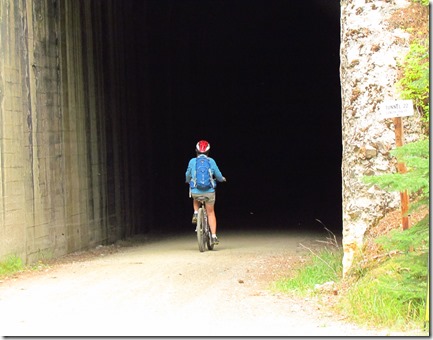
There were more tunnels along the way……a total of ten…..most short, maybe 200 feet or so. All dark…..
IMG_3410

The bike lights worked great and we got comfortable enough to actually enjoy the tunnels.

IMG_3403

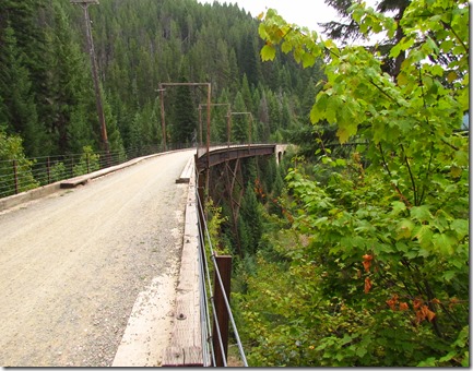
Oh – there were also trestles to ride over. Seven in all. I had thought that they might be scary….

IMG_3416

IMG_3413

But they were actually quite safe feeling. The roadway was wide….

IMG_3427

With a raised boardwalk on each side and a wire railing to provide a sense of comfort.

IMG_3425

The views from the trestles were awesome!

IMG_3426

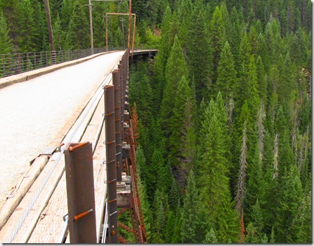
Looking down……

IMG_3428

Fred took this one looking straight down!
IMG_3430

And alongside of the trestle. They were really a work of architecture….

IMG_3419IMG_3420

There were a number of informational signs along the way that added to the experience and our understanding of the building of the railroad through this area.  This one tells of a great fire in 1910.
IMG_3432

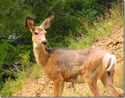
Along the way, we kept our eyes open for wildlife. This deer seemed almost tame, as she just stood on the side of the road while we were eating our sandwiches for lunch. Maybe she was hungry?
IMG_3406

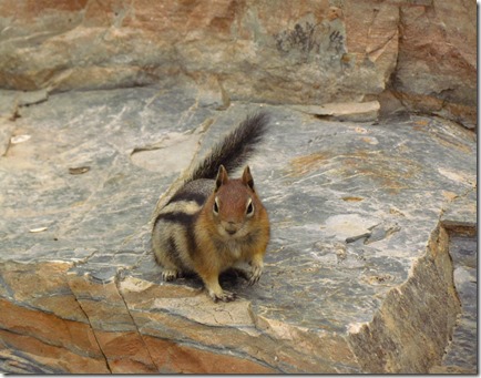
This little guy posed for a picture. He was definitely used to being fed by the bike riders on this trail.

IMG_3438

We got to the end of our ride….Pearson trail head….about 12:45pm. Time enough to relax a bit before loading  up, bikes and all, on the bus. A 30 minute bus ride back to the Roland trail head, where we would have to ride back through the 1.7 mile Taft tunnel to where our truck was parked. This time, the tunnel did not seem so intimidating. We rode much faster and smoother……and, before we knew it, our bike riding adventure was over.

This day was fun! Definitely something that we will have to do again. I see new bikes somewhere in our future.   : )